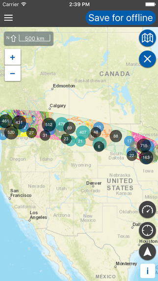
This new app will not only track your current location (even when in airplane mode), but will also give you interesting sight-seeing tips about what is below your aircraft.
Flyover Country is a new app that asks you to download your flight path ahead of time.  Once you are in the air, it uses GPS to plot where you are, and uses the previously downloaded facts to fill you in on what’s below.
Outside Online reviewed the app, and was happy with the results:
The app uses your phone’s GPS chip, even in airplane mode, to track your location and provide fun geographical, geological, and historical facts about what’s below. For example, during the flight, I learned about the HMHS Lanfranc, a hospital ship torpedoed by the Germans during World War I that’s still at the bottom of the English Channel. I also learned that the Rhine River’s headwaters are in southern Switzerland, and I read about the famous Koppenberg hill climb in Ardennes, Belgium, known for crushing cyclists in the Tour of Flanders because it’s as steep as 22 percent and covered in greasy cobblestones.
The downside is, since it uses a pre-downloaded route, they may not have any information about your location if your flight goes off its traditional route. Â They are assuming you’ll take the usual pathway to your destination.
The app itself is created by academics at the University of Minnesota, so I assume it’ll only get better overtime.
With all the US planes in the AA fleet without In Flight Entertainment, it’s nice to find a way to track your flight without having to connect to the internet.
 Le Chic Geek


